MaptimeBmore has Moved to EventBrite!
Date: July 7 2023
Place: Online event
Dear Maptimers,
You’ve probably seen a lot of emails recently from Meetup about reclaiming the MaptimeBmore Meetup account.
Over many months, the MaptimeBmore organizing team - Jonathan, Cheryl, Thayer, Camille, and several other members - have made the decision to move off the Meetup platform to other free systems.
MaptimeBmore isn’t going away, we are just moving off of Meetup. Meetup costs about $200 per year and requires a credit card on-file for renewal. While Meetup says there are over 300 of you mappers, we can’t keep shaking down the same few of you over and over to pay this fee. So we are letting the Meetup account expire and using its system to send you this last message.
Please sign up to our next event on Eventbrite https://www.eventbrite.com/o/maptime-bmore-64433266583, and stay tuned there for more events.
Follow up on Twitter https://twitter.com/maptimebmore
Thanks for the continued support, see you on the next platform and at the next event. July 20th Mappy Hour at R.House
Jonathan, Cheryl, Thayer, Camille
![]()
This site is maintained here: https://github.com/maptime/baltimore
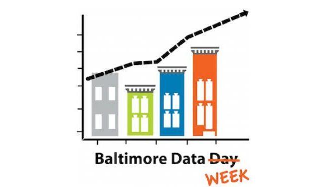
Baltimore Data Week OpenStreetMap Mapathon to Address Neighborhood Data Gaps
Date: July 23 2020
Place: Online event
This year, The Baltimore Neighborhood Indicators Alliance is hosting a full week of presentations, workshops, and events for #BaltimoreDataWeek! Our annual workshops helping neighborhoods access data for their communities will be held online.
Join us, Thursday July 24th at 7pm for an OpenStreetMap presentation and quick mapathon!
In collaboration with MaptimeBmore, mapathon participants will learn how to add and edit points of interest on OpenStreetMap, a free collaborative and editable online map.
Speakers:
Maggie Cawley, OpenStreetMap US Elliott Plack, KSI
Link to Register: https://ubalt.zoom.us/webinar/register/WN_gq0HUv6qQmiDWOB_ZhDK4Q
At this 11th Annual Baltimore Data Day, we will be hosting sessions and workshops all week! Community leaders, nonprofit organizations, governmental entities and civic-minded technologists can come together to see the latest trends in community-based data and learn how other groups are using data to support and advance constructive change. Baltimore Data Week is structured around a series of “how-to” interactive workshops in which people who work with data will explain what data is available, where to find and access data, and how data can be actionable for communities.
Explore the full conference and register for other sessions at https://www.bniajfi.org/data_day.
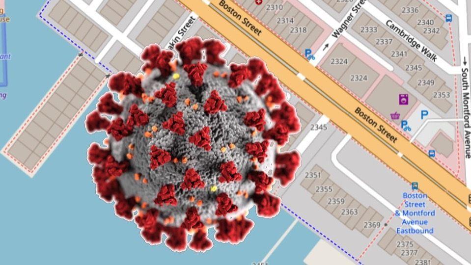
Responding to the Pandemic Bmore food & business options Mapathon on OSM
Date: April 30 2020
Place: Online event
If you are looking for a way to contribute to the effort to flatten the COVID19 curve and help keep your local businesses afloat, Maptime B’more has you covered. We are partnering with OpenStreetMap US on a mapathon to update OSM points of interest, for example the details for restaurants and other businesses, during the COVID19 Stay at Home Order. Some creative people have been putting together lists, like curbside and takeout options, and we want to make sure that they are reflected in OpenStreetMap, to better inform the public about what options are where!
Not familiar with editing OpenStreetMap? No problem it’s really easy, and learning resources will be provided!
We will be having a virtual gathering over Zoom, with an alternative call in phone number. The Zoom details are revealed to those that sign up. The call in phone number and Zoom passwords will be e-mailed the day of.
See the full list of OSM Mappyhours: https://wiki.openstreetmap.org/wiki/Foundation/Local_Chapters/United_States/Virtual_Mappy_Hours#Upcoming_Events
If you do not already have one, to participate you should set up a free OpenStreetMap account: https://www.openstreetmap.org/user/new
TeachOSM CCBC GIS Capstone
Date: March 10 2020
Place: CCBC Catonsville, 800 S Rolling Rd Catonsville MD 21228
Join us as we work with the CCBC Catonsville GIS Capstone course to learn about how OSM integrates many aspects of GIS technology. This meetup will be in collaboration with CCBC GIS professors and the GIS class. We will start with a short presentation about how OSM intersects with topics covered in GIS instruction, including: digitizing, databases/schemas, metadata, data quality, aerial image interpretation, and web GIS. We will then alternate between OSM US and HOT OSM tasking managers to work on important mapping tasks and to understand different map data requirements around the world that OSM can tackle.
Finally, we will demonstrate several ways to download OSM data and load them into a GIS desktop app for visualization or analysis.
Participants new to OSM are encouraged to sign up for an OSM account ahead of time and take the short online tutorial for using the in-browser iD editor. https://learnosm.org/en/beginner/
Food will be provided.
For members who are not current CCBC GIS Capstone students, please bring your own laptop.
Getting there: After 6pm people can park in any lot, but the event will be in building “Classroom and Laboratory Building” in Lot#2. Location: CLLB 015 (Classroom and Laboratory Building) Catonsville campus of Community College of Baltimore County
https://www.openstreetmap.org/way/477006172#map=17/39.25453/-76.73533
Directions from I-95: Take exit 47AB onto I-195 At the fork go West towards MD 166 Catonsville At the end I-195 Turn Right on South Rolling Rd. Turn Left onto Campus Dr. into CCBC Catonsville (big blue and white sign) At the top of the hill Make your first Right to be on the outer side of the Campus Dr loop Pass Lot 1, Lot 2 and the CLLB building on your left After passing the ARTS building on your right Turn right and park in Lot 3 Walk back to the CLLB building, the GIS Lab is in the basement (CLLB 015) Please park in Lot 3 or Lot 5, do not park in Lot 2 (faculty/staff only).
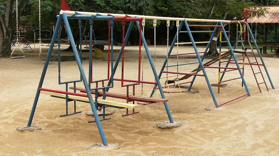
Mapping playscapes in OSM
Date: February 18 2020
Place: Zen West, 5916 York Rd Baltimore MD 21212
Come join us at Zen West to continue mapping playgrounds and play areas in Baltimore. All are welcome, including first-timers new to OSM and Maptime. Bring a laptop if you have one, if not you can share with someone too. OSM mapping is easier with a mouse, but works okay with a trackpad if you don’t have a mouse. We will focus on completing the playground mapping Task on the OSM US Task Manager: https://tasks.openstreetmap.us/project/160
Let’s map all the play areas and play deserts in Baltimore!