Level up your OSM skills
The next Maptime Bend meetup is scheduled for Thursday, April 2!
#Next level OSM
Join us for a special Field Trip edition of Maptime Bend! We’ll go outside (assuming the weather is nice) to collect some nearby path data with GPS handsets or smartphones, then bring that data back to the “lab” and use it to create new paths in OpenStreetMap.
##Recording GPS tracks
Most GPS handsets and many mobile phone apps allow you to capture tracks. Tracks are a series of points that are recorded in order. Most handsets and apps record a point per second or a point for every meter traveled. These tracks can then be downloaded to a computer and uploaded to OpenStreetMap, or, with some smartphone apps, uploaded directly.
Here’s the OSM wiki page about GPS tracks.
###Waypoints
Most GPS handsets and many apps also allow you to record waypoints, which are discrete records with a single x/y coordinate. These are useful for creating Points of Interest (POIs) in OSM.
##Using tracks in OSM
Once you’ve recorded some tracks, it’s time to upload to OpenStreetMap. Now, you (usually) don’t actually convert your GPS tracks directly to geometry in OSM. Instead, you use the tracks you’ve created to manually digitize the features you recorded. It probably seems a little silly to record GPS tracks, upload them and then trace them, but honestly trying to slice and dice GPS tracks into features would take nearly the same amount of time as simply creating new features via the iD editor.
OSM wiki page about uploading GPS tracks
OSM wiki page on smartphone apps for capturing tracks
##Our project
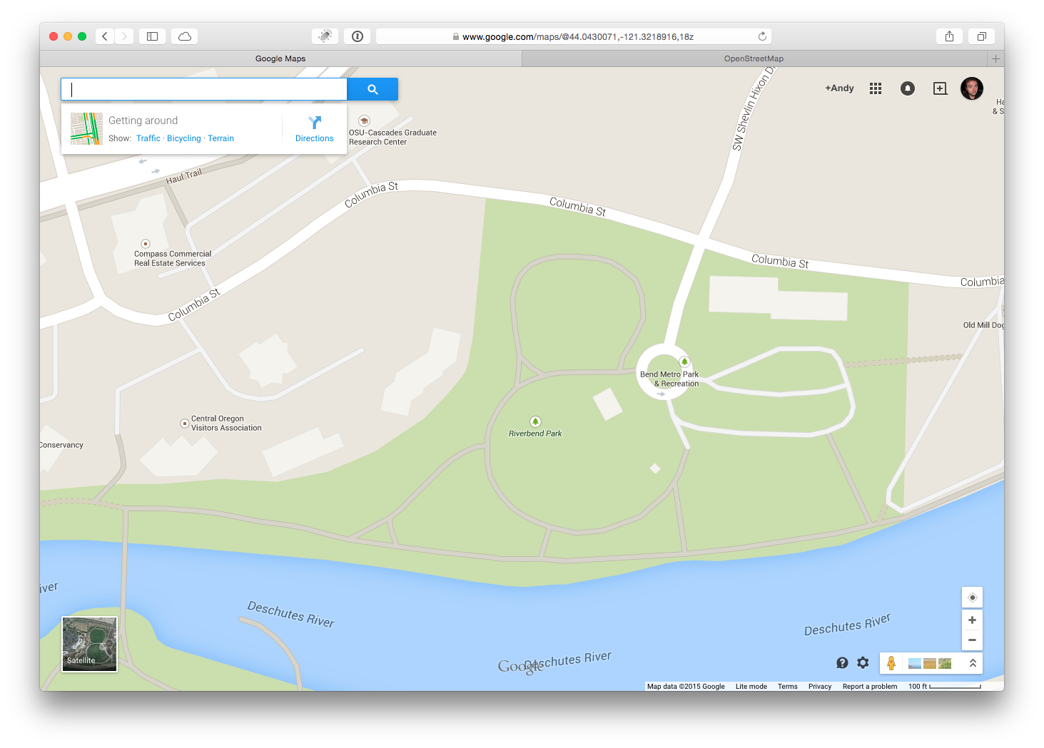
###Riverbend Park in Google Maps

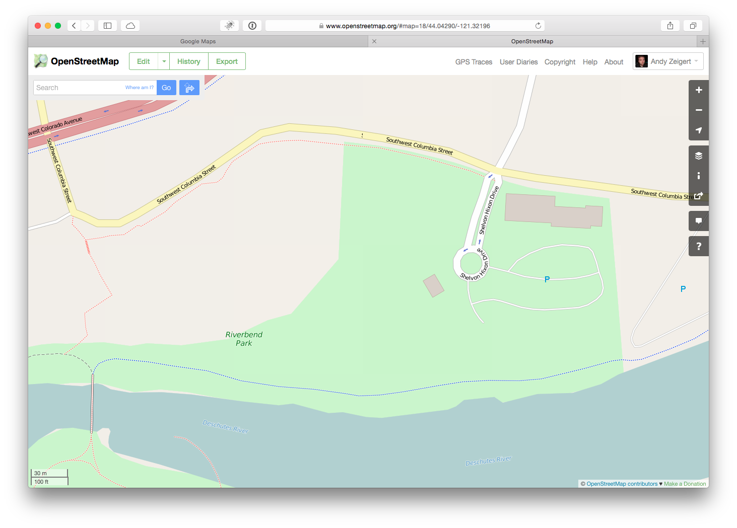
###Riverbend Park in OpenStreetMap

As a group, we’re going Riverbend Park to record some tracks and waypoints to improve OSM’s data. You’ll need:
- A GPS handset or smartphone
- A notebook or note-taking app
- An OpenStreetMap account (create a new account here)
- Feet
Step 1
Walk to the park. It’s about 10 minutes from BendTech. Once at the park, we’ll divide up into pairs to record tracks and waypoints. (One track is fine, but two tracks are useful for determining accuracy). We’ll spend about 30 minutes recording data. Make sure to write down any important info about your tracks, such as surface type. If recording a waypoint, be sure to collect as much info as possible about it.
Step 2
Return to “the lab” to download our tracks from our handsets and upload them to OSM.
Step 3
Use the info we gathered and the tracks we’ve uploaded to vastly improve the OSM data for Riverbend Park!
Step 4
Drink beer and profit!
Bonus: Open Trails
If there’s time, we’ll go a little more indepth into the Open Trail System Specificiation, or OpenTrails, which is a way to record trail info in a standard, re-usable format.