Mapping Maryland from the Willard Hackerman Map Collection
Date: March 20 2019
Place: George Peabody Library, 17 E Mt Vernon Pl Baltimore MD 21202
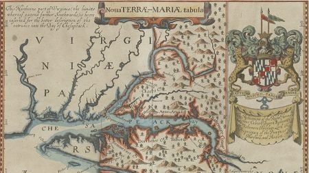
Join us for a special tour of the Willard Hackerman collection of Maryland maps at the George Peabody Library. Learn about the collection, William Hackerman, GIS at Hopkins, and other Sheridan Libraries resources from curators Jim Gillispie and Paul Espinosa.
From colonial impressions of the Chesapeake Bay to detailed city plans for guiding Baltimore’s rapid expansion, this exhibition features over thirty of the most stunning and historically significant maps of Maryland from the collection of the late businessman, philanthropist, and Johns Hopkins alumnus Willard Hackerman. The maps are brought together with related rare books and prints, ephemera, and digital story maps to reveal the passion of a collector, the early mapping of Maryland, and the potential of combining historical maps with modern data to re-examine the past. Highlights include John Ogilby’s “Lord Baltimore Map” from 1671, a hand-colored edition of Thomas H. Poppleton’s 1822 “Plan of the City of Baltimore,” and engraved views of Baltimore from the Harry N. Baetjer Collection of Historical Maps and Prints.
More information can be found at https://www.library.jhu.edu/about/exhibitions/
Light refreshments will be available, including beer and wine, as you peruse the collection.
17 Mt. Vernon Place is the main entrance for the Peabody Institute and the George Peabody Library.
Street parking is available and parking is available for a fee at several locations:
- Peabody Parking Garage at 616 St. Paul Street (on the right, approaching the intersection at Centre Street)
- Former Baltimore Sun Garage at 601 N. Calvert Street
- Central Parking (across from the Walters) at 600 Cathedral Street
- Franklin Street Garage at 15 W. Franklin Street
Visitors may also take advantage of the Charm City Circulator or BaltimoreLINK.
See you there!

Visualizing Early Baltimore circa 1815
Date: February 13 2019
Place: UMBC Information Technology and Engineering (ITE) Building, 1000 Hilltop Rd Baltimore MD 21250
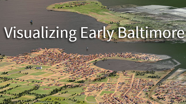
Join us as we meet with UMBC’s Imaging Research Center Professor Dan Bailey to discuss his work building a 3D map and visualization of Baltimore circa 1815. The goal of the project is to recreate Baltimore’s buildings, roads, topography, and land use from over 200 years ago! You can learn more about the project and view the current 3D map here, http://earlybaltimore.org/. We are eager to talk to Professor Bailey about how he has used GIS to build out this unique dataset and to learn how the MaptimeBmore team might be able to help moving forward. Cover photo credit: http://earlybaltimore.org/, https://www.irc.umbc.edu.
Location: UMBC IRC, Room 101 in the ITE building at UMBC. Parking: Parking should be free in Lot 8 just nearby the Performing Arts Center.

New Year Mappy Hour
Date: January 23 2019
Place: Mt Vernon Marketplace, 520 Park Ave Baltimore MD
Join us at the Marketplace in Mt. Vernon for a mappy happy hour! Meet new friends, learn about new datasets and projects in Baltimore, have a good time! We’ll try to find a big table and put out MaptimeBmore signs.
MaptimeBmore Happy Hour
Date: December 12 2018
Place: R. House , 301 W 29th Street Baltimore MD 21211
Join us at RHouse in Remington for a mappy happy hour! Meet new friends, learn about new datasets and projects in Baltimore, have a good time! We’ll try to find a big table and put out MaptimeBmore signs.
Lets Get Mapping
Date: November 14 2018
Place: University of Baltimore Law School, 1401 North Charles St. Baltimore MD
Hey Maptimers, let’s make some maps! Come join us at UB on National GISDay, Wednesday November 14th, to kick off some new mapping projects for Baltimore. We’ve got a bunch of interesting ideas for mapping projects we want to get started and we want you to come help. Bring your ideas, your datasets, your energy! If you have a laptop computer and need help downloading GIS datasets and software we can help with that too.
We will provide the space and light snacks. There are plenty of places nearby for food. Further instructions about parking and finding us inside the 11 W. Mt Royal building to follow.
Check out the minutes from our last meeting to learn more about some of the projects we want to talk about, https://github.com/maptimebmore/meeting-minutes