1896 Streetcar OSM etc. Hack
Date: October 23 2019
Place: 4709 Harford Rd, 4709 Harford Rd Baltimore MD 21214
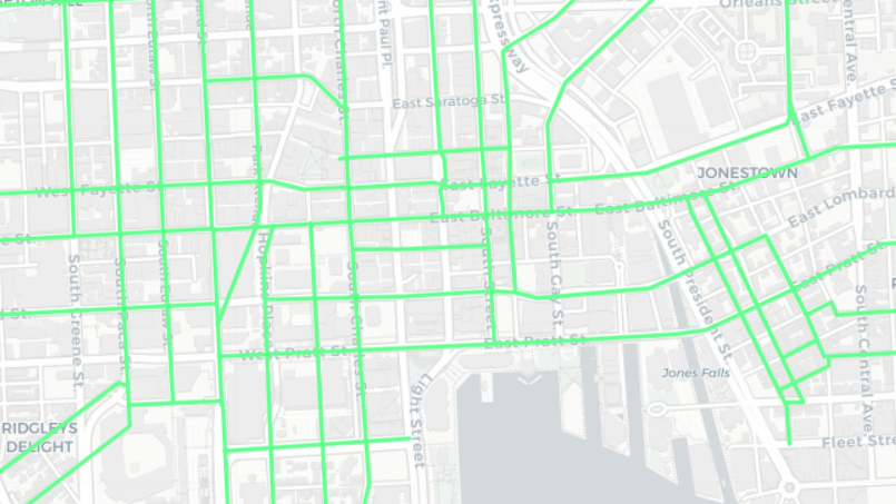
Join us at the Function Coworking Community space in Lauraville to continue working on the 1896 Streetcar map, to do some OSM mapping, and for general mappy, hacky things.
The initial digitizing of the Bromley map atlas is complete: https://maptimebmore.herokuapp.com/. The next steps are to do some web map coding following the sample app we created https://github.com/maptimebmore/historical-street-car-mapping, and to plan the next features for the app.
Interested in some OSM mapping as well? That is okay too, just come on down.
We’ll provide the venue, wifi, and food. Bring a laptop if you have one, if not, I’m sure someone will be happy to share! Please bring a few dollars to contribute to the dinner fund for the night and feel free to post suggestions for food in the comments.
Location: Function Coworking Community space 4709 Harford Rd Baltimore, MD 21214
It is half a block north of Moravia Ave on the east (right) side of the street, and the 2nd building south of Rosekemp Ave. Open Street Map still has the building as its previous tenant, the American Beauty Academy. It has been completely remodeled and is a very nice space.
Parking: There is ample free street parking at that time of day, the PayToPark meter period ends at 6pm. The closest bus routes are the 54 (Harford) and 28 (Harford at Moravia). Note that the 54 bus approximates the route of the old #19 streetcar.

CCBC Geospatial Applications Program Meetup
Date: September 24 2019
Place: CCBC Catonsville, 800 S Rolling Rd Catonsville MD 21228
Join us at CCBC Catonsville as we meet with the Geospatial Applications Program to discuss their on going projects, have some lightning talks, and then some hacking and networking time.
Food will be provided.
Location: CLLB 015 (Classroom and Laboratory Building) Catonsville campus of Community College of Baltimore County
https://www.openstreetmap.org/way/477006172#map=17/39.25453/-76.73533
Directions from I-95:
Take exit 47AB onto I-195
At the fork go West towards MD 166 Catonsville
At the end I-195 Turn Right on South Rolling Rd.
Turn Left onto Campus Dr. into CCBC Catonsville (big blue and white sign)
At the top of the hill Make your first Right to be on the outer side of the Campus Dr loop
Pass Lot 1, Lot 2 and the CLLB building on your left
After passing the ARTS building on your right
Turn right and park in Lot 3
Walk back to the CLLB building, the GIS Lab is in the basement (CLLB 015)
Please park in Lot 3 or Lot 5, do not park in Lot 2 (faculty/staff only).

Hello, Baltimore!
We are the Baltimore Chapter of Maptime! Our mission is to open the doors of cartographic possibility to anyone interested by creating a time and space for collaborative learning, exploration, and map creation using mapping tools and technologies.
Find us on Meetup and get to know other mappers in the Baltimore area.
We are supported by Fearless, a full stack digital services firm in Baltimore. Please reach out through Meetup or Twitter if you would like to help support MaptimeBmore through sponsorship of our Meetup.com fees, or by hosting/sponsoring an event.
TUgis 2019 Mappy Hour
Date: August 07 2019
Place: Charles Village Pub & Patio, 19 W Pennsylvania Ave Towson MD 21204
Headed to TUgis this year? Join us at Charles Village Pub and Patio in Towson around 7ish after the TUgis Networking Happy Hour on Wednesday the 7th. Help us celebrate the one-year anniversary of the reborn MaptimeBmore by turning all that exciting TUgis energy into some awesome new mappy ideas!
More details to follow. In the meantime, make sure you register for TUgis https://tugisconference.com/

Part 2 OpenStreetMap Hackathon for Baltimore Data Day
Date: July 08 2019
Place: William H. Thumel Sr. Business Center, 11 W Mt Royal Ave Baltimore MD 21201
**To enter the building (11 W. Mount Royal Avenue) enter 1145# on the keypad located to the left of the doors. The building is secure-access only. Head down the steps in the lobby and we will be in the first classroom on the right! **
Food update! I will be providing some snacks tonight, including a veggie/cheese tray, pretzels, popcorn, cookies, and iced tea. Bring a water bottle too, we have bottle refill spouts on our water fountains. There’s a few dining options nearby on Charles Street, including Starbucks, Subway, Potbelly, and Chipotle.
Thanks to everyone that has expressed interested in participating in the Baltimore Data Day OpenStreetMap Hackathon!
I am hosting an open, drop-in-anytime OSM training at the University of Baltimore on July 8th from 6-9pm for anyone that couldn’t join us at R. House on June 25th. This will be an opportunity for all of us to continue to familiarize ourselves with the iD editor and to identify neighborhoods and themes we would be interested in working on at Baltimore Data Day on July 12th.
Join us on the 8th if you’re interested in serving as a participant or volunteer mentor at Baltimore Data Day, or, if you can’t make it on the 12th and still want to participate in some OSM editing!
Please bring a laptop- there will be secure Wifi. I will also have some food and drinks for everyone. Feel free to stay the full 3 hours or stop by when your schedule permits!
Parking is free on the street after 6pm and there are tons of public transportation options in the area, including the MTA, MARC-Penn Station, and the Circulator.
Below is some information about Baltimore Data Day and the Hackathon on July 12th. Hope to see you there!
Baltimore Data Day (BDD) is a free annual event hosted by the Baltimore Neighborhood Indicators Alliance at the University of Baltimore. This summer will be our 10th year hosting this event which is open to community organizations, non-profits, city agencies, researchers, students, and residents. BDD is a good opportunity to network in the city around topic areas such as transportation, housing, crime, education, quantitative data, and GIS.
The 2019 event will be held on Friday, July 12th at the University of Baltimore. At the event will be hosting a casual lunchtime/afternoon (12-2pm) workshop on OpenStreetMap where we can bring together GIS professionals and Baltimore City residents to add community assets to the OSM platform. Our goal is to ensure that all neighborhoods in the city are richly represented.
More info, including registration: https://www.bniajfi.org/data_day OpenStreetMap: https://www.openstreetmap.org Baltimore Neighborhood Indicators Alliance: https://www.bniajfi.org
